If you’ve ever watched a delivery date slip, you already know how quickly transport costs can sneak into everyday life. China is betting that a new 134.2-kilometer (83-mile) waterway in Guangxi, the Pinglu Canal, can shorten the trip from inland rivers to the sea and, in theory, reduce fuel burn on the way.
Official updates say the project is in its final stretch, with recent reports pointing to navigation targets in September 2026 and wider operations by the end of 2026. The big question is not just speed or concrete, but can a mega logistics shortcut protect a living river system once traffic ramps up?
A trade shortcut built for a shifting map
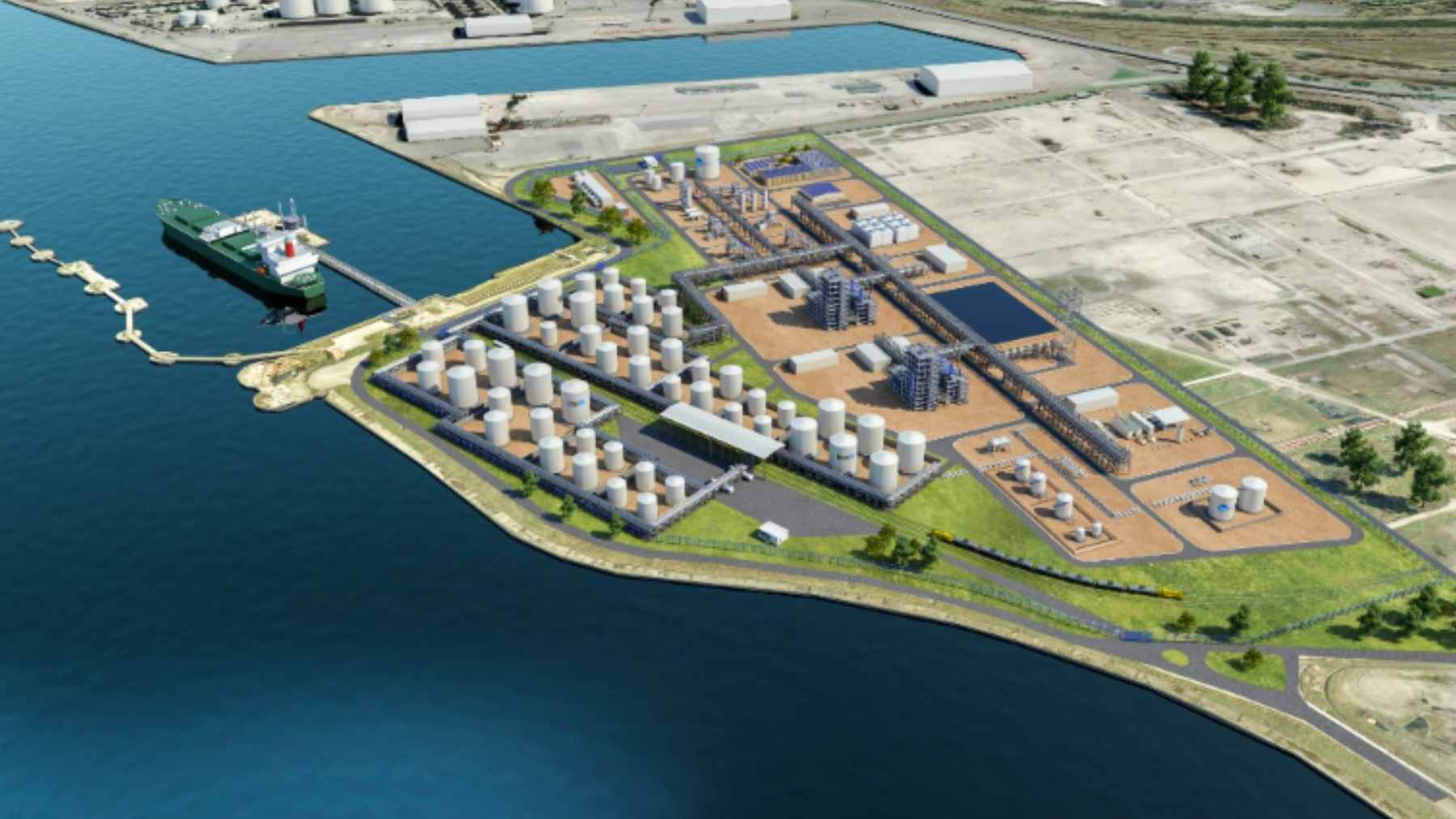
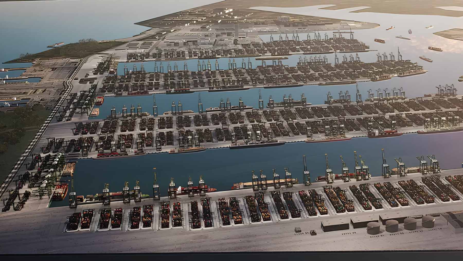
Pinglu is designed to shorten the voyage between inland river ports and the Beibu Gulf by around 560 kilometers (346 miles). China Daily has reported a total investment of about ¥72.7 billion ($10.7 billion) and projected annual transport cost savings of more than ¥5.2 billion ($763 million), along with a depth designed for 5,000-ton cargo vessels.
This matters more now that China’s export growth is leaning toward Southeast Asia. Reuters reported that exports to ASEAN rose 13.4% in 2025, while exports to the United States fell 20% in dollar terms, and Xinhua has described Pinglu as a flagship project tied to the New International Land-Sea Trade Corridor.
Xinhua has also described construction progress in unusually concrete terms. As of February 28, 2026, the project had completed 92.2% of planned investment and excavated about 308 million cubic meters of material, with most of the canal alignment already taking shape.
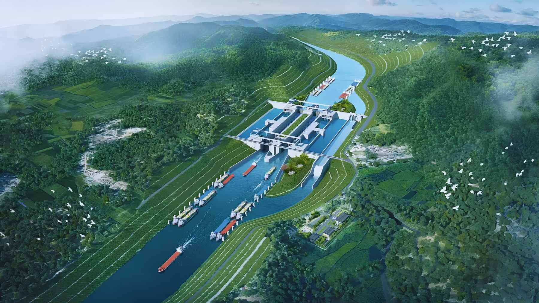
The canal runs on water, not just concrete
Ship locks act like water elevators, and they can burn through huge volumes of freshwater if they are not designed carefully. Local reporting under Xinhua says Pinglu’s “water saving” lock design can cut lock water use by about 60%, with estimates of around 1 billion cubic meters of water saved in a year of operation.
That is why scheduling and water management are being treated as part of the infrastructure, not an afterthought. Guangxi officials have already issued “river, canal, sea” integrated dispatch rules intended to coordinate the canal with Beibu Gulf port operations once navigation begins.
There is also the climate angle that gets less attention than the engineering photos. A 2024 International Council on Clean Transportation briefing, citing European audits, put inland waterway freight at about 33 grams of CO2 per metric ton-kilometer in 2018, far below road freight at 137 grams, even though the real outcome depends on engines, fuels, and how full vessels sail.
If the freight shift is real, fewer truck miles can also mean less diesel exhaust along crowded highways.
Sensors, software, and the “green canal” pitch
Environmental protection on a canal like this is starting to look like a data problem. In a Xinhua report from early 2026, engineers at the Qingnian hub were shown using a fishway monitoring platform that displays fish passage counts and hydrological information, a tool meant to support migration and help restore the watershed ecosystem.
And the canal still has to prove it can run safely in the real world, not just on paper. Xinhua’s app reported on May 2, 2026 that the project entered a “with water” testing phase for a lock, focusing on seal performance, operating parameters, and the centralized control system that runs key equipment.

Ecology is where the project can win or lose credibility
China Daily reported that the project passed its environmental impact assessment review in May 2022, which is supposed to set the baseline for mitigation and long-term monitoring. But the sheer scale, including hundreds of millions of cubic meters excavated, means construction and dredging pressures are not a hypothetical risk.
Researchers are trying to measure those pressures with more than slogans. A March 2026 study in the journal Water found, in a Pinglu Canal dredging case study, that the quality of discharged residual water carried the highest indicator weight at 0.0839, and several sections were rated “mild” to “moderate” impact in the model.
On land, another study on wildlife habitat connectivity around the canal area proposed restoration steps that include building or upgrading habitats at ecological “pinch points” and adding wildlife passages across the canal.
The paper reported modeled gains of 28.13% in habitat area and 33.41% in migration corridors after optimization, which is a useful reminder that design choices can change outcomes.
Rules and security in a river-sea transition zone
Before shipping can scale up, regulators have to remove legal gray areas. On April 10, 2026, Guangxi’s Maritime Safety Administration and the regional transport department formally set the canal’s river sea boundary at the Qinjiang Bridge on the G75 expressway, clarifying which inland waterway rules apply north of the line and which maritime safety law applies south of it.
This is also where military and defense starts to overlap with business, even without a single warship in sight. Any corridor that reliably moves fuel, metals, and industrial components can become part of national resilience, and clear jurisdiction is basic safety infrastructure in an emergency.
The official statement was published on Guangxi Maritime Safety Administration.