Snow in the Andes is not just a postcard problem. For cargo drivers, tour operators, exporters, and border towns, it can decide whether a route is open, delayed, or simply impossible.
That is why the planned Agua Negra Tunnel is drawing fresh attention. The project would connect Argentina’s San Juan province with Chile’s Coquimbo Region through a high mountain corridor that works all year, replacing a seasonal crossing with a safer and more predictable route.
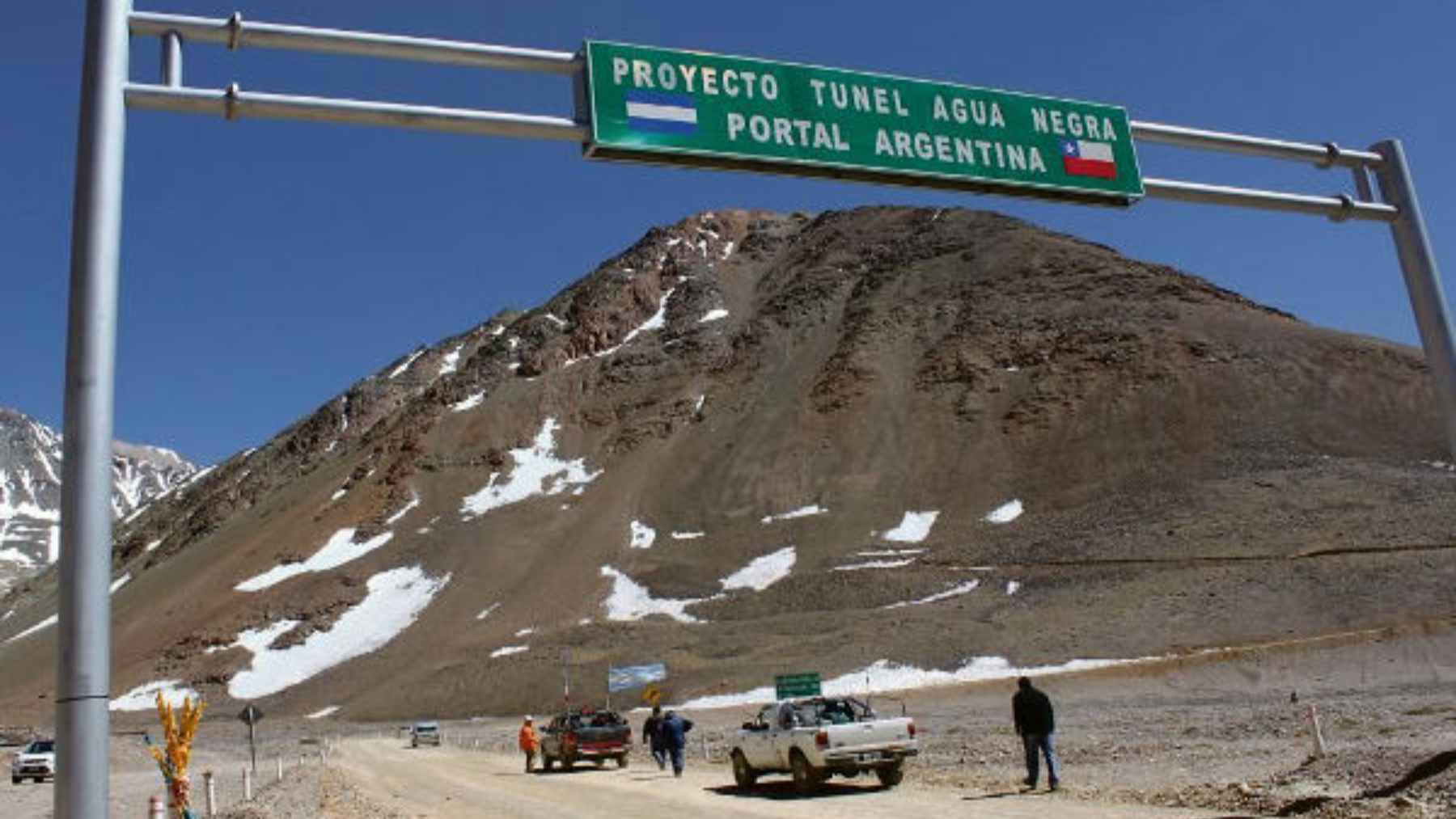
The planned tunnel route is described as 8.7 miles long and more than 13,000 ft. above sea level.
A crossing that winter can shut down
The existing Agua Negra Pass can be used during the summer season, but snow and harsh mountain conditions often block it in winter. When that happens, freight has to shift to other crossings that may be farther away, more crowded, and more expensive for regional supply chains.
That sounds like a logistics detail until you picture a truck loaded with fruit, mining equipment, or parts for a renewable energy project waiting for a weather window. A permanent passage would not make the Andes disappear, of course, but it could make trade across them less dependent on the calendar.
The Government of Coquimbo has framed the tunnel as a way to achieve a more efficient, safe, and permanent connection between the two countries. Regional officials have also linked modernized border connectivity with lower logistics costs and stronger binational corridors.
It is bigger than one tube through rock
The public shorthand is a 9-mile tunnel, but the official plan is more complex. EBITAN, the binational tunnel entity, describes the project as two tunnels of 8.7 miles each, with about 72% of the route on the Argentine side and the rest in Chile.
Two long tubes high in the Andes are not just a drilling challenge, they are a safety, ventilation, rescue, maintenance, and operations puzzle. At more than 13,000 ft., every machine, worker shift, and supply delivery has to deal with thin air and extreme weather.
This is where the project starts to feel less like a road and more like a piece of strategic technology. Sensors, traffic controls, emergency systems, border processing, and weather monitoring would all help determine whether the crossing works smoothly in real life.
Why exporters are watching
For Argentina, the big prize is access to Chilean Pacific ports. The corridor is expected to tie San Juan with other provinces such as Santa Fe, Córdoba, Catamarca, and La Rioja, making it easier for products to move west toward Asian markets instead of taking longer routes through the Atlantic side.
Mining, agriculture, and renewable energy are the sectors most likely to pay close attention. A mine does not only ship minerals, and a farm does not only ship fruit. They also need fuel, spare parts, machinery, workers, digital systems, and reliable schedules.
That is why officials keep talking about logistics costs. In practical terms, even a few hours saved at the border can matter when a shipment has a port slot, a refrigerated container, or a contract deadline waiting on the other side.
The green question
A tunnel can be good for the climate in one narrow way if it reduces long detours, idle time, and congestion at overloaded crossings. But that is only part of the picture, and it is the easy part to sell.
The harder question is what a year-round corridor does to fragile mountain and valley landscapes. Chilean planning documents for the Elqui area point to the need to safeguard watercourses, rural land, natural landscapes, biodiversity, and archaeological resources while managing pressure from urban and productive uses.
That is where the environmental story really begins. More reliable access can bring tourism and jobs, but it can also bring more traffic, more roadside development, and more demand for services in places that were not built for constant pressure.
The tunnel may solve a winter transport problem while creating a year-round planning test.
Chile is already preparing nearby roads
On the Chilean side, work around the corridor is moving through access roads and related planning before the tunnel itself becomes a finished crossing.
Chile’s Public Works Ministry in Coquimbo announced a tender for about 2.4 miles of Route 41 CH expansion, along with a consultancy for paving the first 8.7 miles of an unpaved high mountain section tied to consolidating the Agua Negra Pass.

That might not sound dramatic, but projects like this often arrive in layers, first with roads, studies, border upgrades, and local traffic fixes, then with the larger engineering job everyone notices.
On the Argentine side, the main excavations had still not begun in the background material provided for this story. That is an important distinction because the tunnel is being discussed as a strategic priority, not as a completed or operating route.
Money, politics, and the clock
The financial scale is large enough to explain why the project has moved in waves for years. In an earlier financing stage, Chile’s Public Works Ministry said the Inter-American Development Bank approved a credit line of up to $1.5 billion, with first stages of $150 million for Chile and $130 million for Argentina.
Those figures show the scale, but not the finish line. A mountain tunnel needs stable funding, environmental permitting, procurement, geological certainty, and political coordination that lasts longer than a news cycle.
For now, the strongest message is that both sides are again treating Agua Negra as more than a local road. The trouble is, the clock is moving faster than bureaucracy, especially for exporters trying to cut costs and mountain communities trying to plan for growth.
What to watch next
The next clues will not only come from speeches. Watch the tenders, access road upgrades, environmental reviews, customs modernization plans, and any formal binational timeline for excavation.
If the project advances, it could reshape how parts of Argentina reach the Pacific and how Chile’s Coquimbo Region positions itself in South American trade. If it stalls, the current pass will remain what it is today for the most part, a spectacular but seasonal link across one of the world’s toughest mountain chains.
The official statement was published on GORE Coquimbo.