What happens when the world’s internet cables, energy pipes, and shipping lanes all become targets at the same time? That is no longer a distant military scenario.
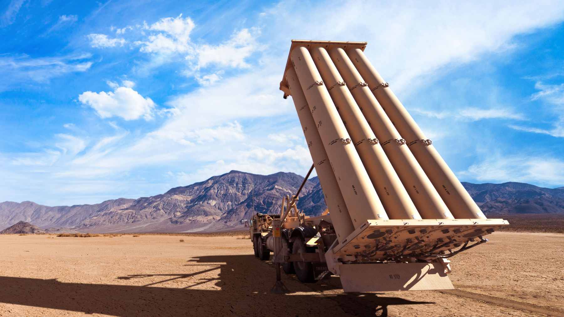
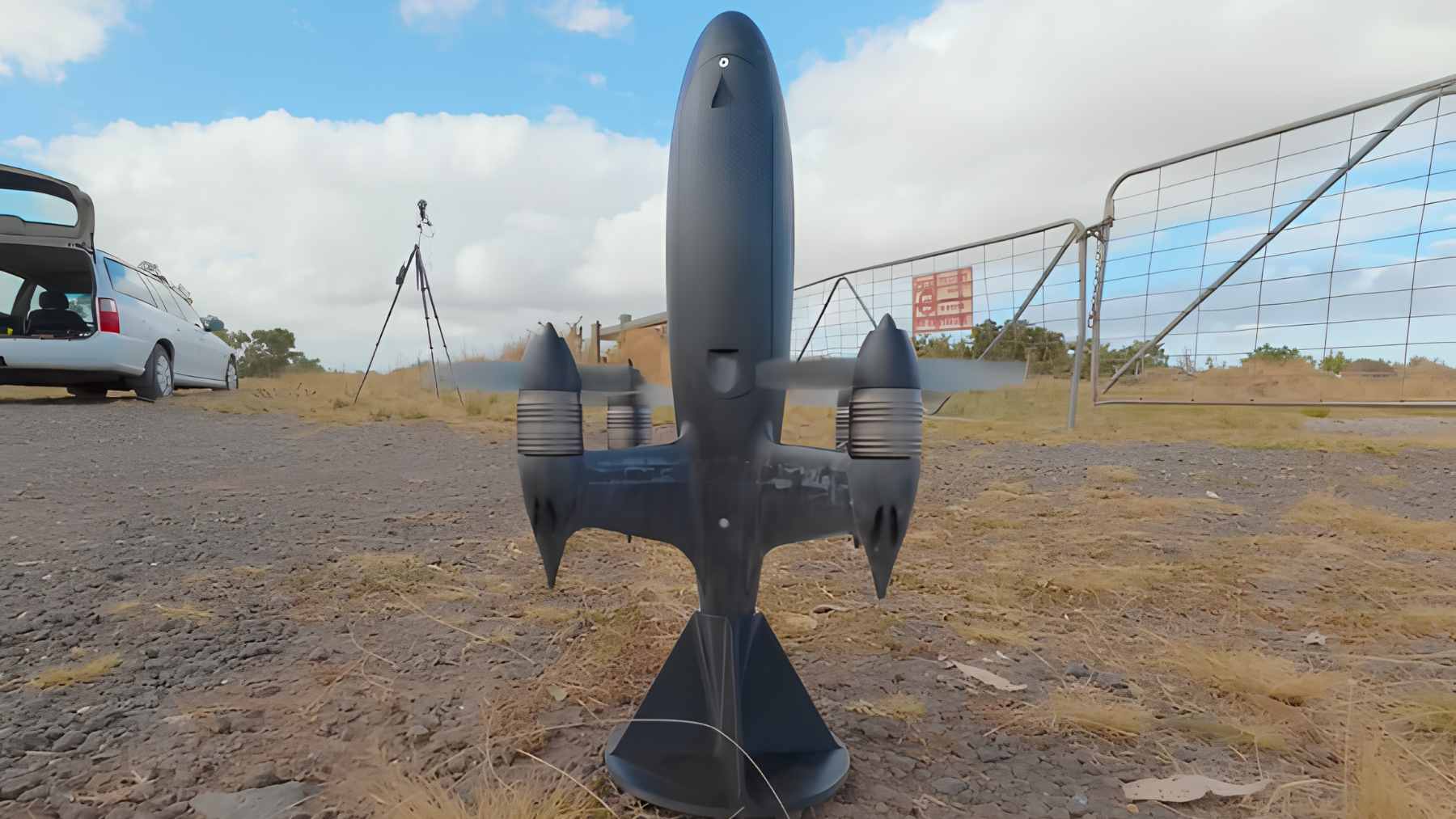
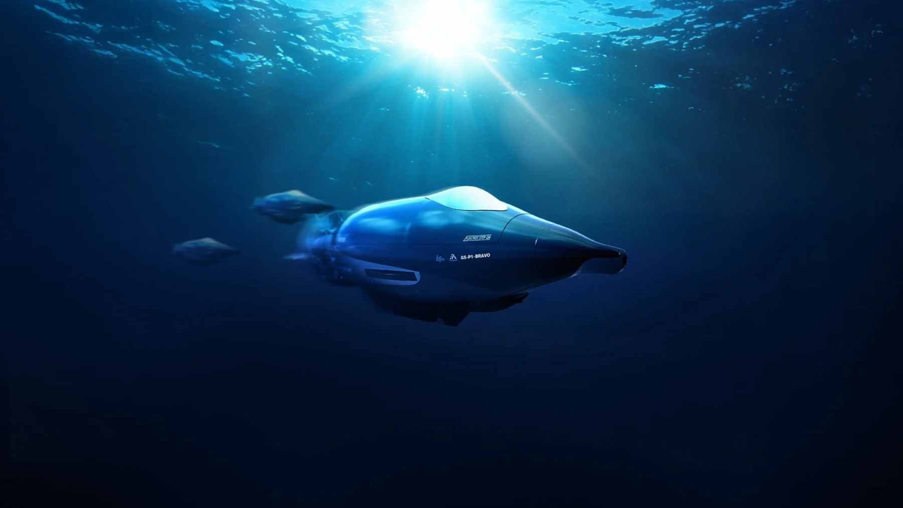
Euroatlas’s Greyshark Foxtrot is a German autonomous underwater vehicle built to stay down for up to 16 weeks, scan the seabed with 17 sensors, and watch the kind of hidden infrastructure most people only notice when it fails.
The environmental angle is easy to miss, but it matters. A severed cable, a damaged power link, or a minefield in a narrow sea lane can mean more ships, more fuel burned, more noise, more risk to marine ecosystems, and higher prices that eventually show up in the electric bill or at the gas pump.
The ocean floor is not empty space anymore. It is the basement of the global economy.
Greyshark is built for long watch
Euroatlas describes Greyshark as a long-endurance, multi-mission AUV for contested maritime domains, with missions including critical undersea infrastructure monitoring, mine countermeasures, reconnaissance, and coastal patrol. The company says the platform can operate for up to 16 weeks and travel as far as 10,700 nautical miles at 4 knots.
DSEI Gateway reported that the Foxtrot prototype entered the water in the second week of April 2026 and was being tested at SeaSEC in Rostock. Under current planning, the fuel-cell Foxtrot is expected to complete development in 2027.
Why hydrogen changes the equation
Most underwater drones are limited by battery life. The Foxtrot version is different because it uses hydrogen fuel-cell propulsion, which gives it the kind of endurance that a short-range battery model cannot match. At the end of the day, that means fewer interruptions and less need to bring the vehicle back to a ship or port.
That matters in places where recovery is hard, dangerous, or simply too expensive. Think about Arctic waters, long pipelines, wind farm corridors, or a cable route stretching for hundreds of miles. Sending a crewed vessel over and over again is slow, costly, and visible.
The sensors are the real story
Interesting Engineering reported that Greyshark carries 17 high-resolution sensors and can produce seabed imagery at 1.6 inches per pixel. That is detailed enough, in practical terms, to spot small underwater hazards rather than just vague shapes on a sonar screen.
Euroatlas’s brochure lists synthetic aperture sonar, multibeam echo sounder, electromagnetic sensors, laser imaging and measurement, passive and active acoustic sensors, depth sensors, and temperature sensors. The same technology suite also includes automatic target recognition, collision avoidance, and dynamic mission adjustment.
Hormuz shows the stakes
The Strait of Hormuz is a hard place to exaggerate. The U.S. Energy Information Administration said flows through the strait in 2024 and early 2025 made up about one-fifth of global oil and petroleum product consumption and more than one-quarter of global seaborne oil trade.
Reuters reported in April 2026 that Iran had recently deployed about a dozen mines in the strait and that their exact locations were not publicly known. In that context, Euroatlas officials told Interesting Engineering that six Greyshark vehicles, operated by one person, could map the entire strait in no more than 24 hours.
Can a drone submarine make a dangerous chokepoint safe by itself? No, but it can remove some of the guesswork, and in mine-clearing, guesswork is where danger likes to hide.
The Baltic problem is closer to home
Europe has already had a preview of this problem. Reuters reported that Finnish police found a seabed drag track stretching for dozens of kilometers after a tanker carrying Russian oil was suspected of damaging one power line and four telecom cables in the Baltic Sea.
Finnish customs also believed the vessel was part of Russia’s “shadow fleet,” while Russia denied involvement in previous Baltic infrastructure damage incidents.
NOAA says more than 95% of international data and voice transfers are routed through submarine fiber optic cables. That means the seabed is not only a military concern, but where a huge part of daily life quietly travels, from payments and cloud storage to video calls and emergency communications.

Autonomous does not mean invisible
Greyshark is not just a camera with fins. Euroatlas says its onboard AI supports automatic target recognition, collision avoidance, and dynamic mission adaptation, while swarm capability allows coordinated missions and real-time data sharing between units.
That raises a new question. If underwater drones can spend months watching infrastructure, who sets the rules for where they operate and what they collect? For the most part, the technology is moving faster than the public conversation around seabed surveillance.
A new layer of ocean security
The strongest case for Greyshark is not that it replaces sailors, divers, or mine hunters. It is that it can sit inside the gaps between them. A crewed vessel can respond, but a persistent AUV can notice the first odd shape near a cable or the first suspicious change on the seabed.
This is where the environmental story and the defense story meet. Fewer blind spots under the sea could mean faster repairs, safer mine clearance, and less scrambling when a route that carries oil, gas, electricity, or data is suddenly interrupted. Not glamorous, but highly important.
The official product information was published on Euroatlas.